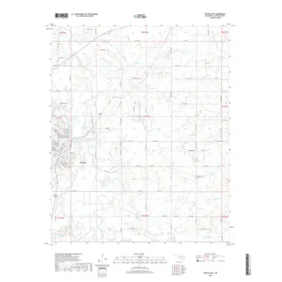
2018 Map of Poteau East
USGS Topo · Published 2018About this map
Poteau anchors the western edge of this landscape, its grid of streets such as Roanoke Ave and Grand Ave showing the city's development east of the Poteau River. The surrounding terrain is defined by the complex hydrology of the valley, where the main river channel is paralleled by the Lost Poteau River and secondary waterways like Riddle Cr and Nail Cr. This 2018 survey captures the interface between the urban center and the rural settlements of Gilmore and Neff to the east.
Find a feature on this map
81 named features on this map. Tap any name to fly to it.
Don’t see what you’re looking for? This feature index may not catch every label — zoom into the map to look around manually.
Map Details
Editions of this 2018 Poteau East Map
This is the sole edition of this map. No revisions or reprints were ever made.
Other maps of this area

1887 · Poteau Mountain #2
USGS Topo · 1:62,500

1887 · Greenwood
USGS Topo · 1:62,500

1890 · Fort Smith
USGS Topo · 1:125,000

1890 · Poteau Mountain
USGS Topo · 1:125,000

1899 · Poteau Mountain
USGS Topo · 1:125,000

1900 · Sallisaw
USGS Topo · 1:125,000

1900 · Winding Stair
USGS Topo · 1:125,000

1909 · Winding Stair
USGS Topo · 1:125,000

1911 · Sallisaw
USGS Topo · 1:125,000

1943 · Fort Smith
USGS Topo · 1:125,000