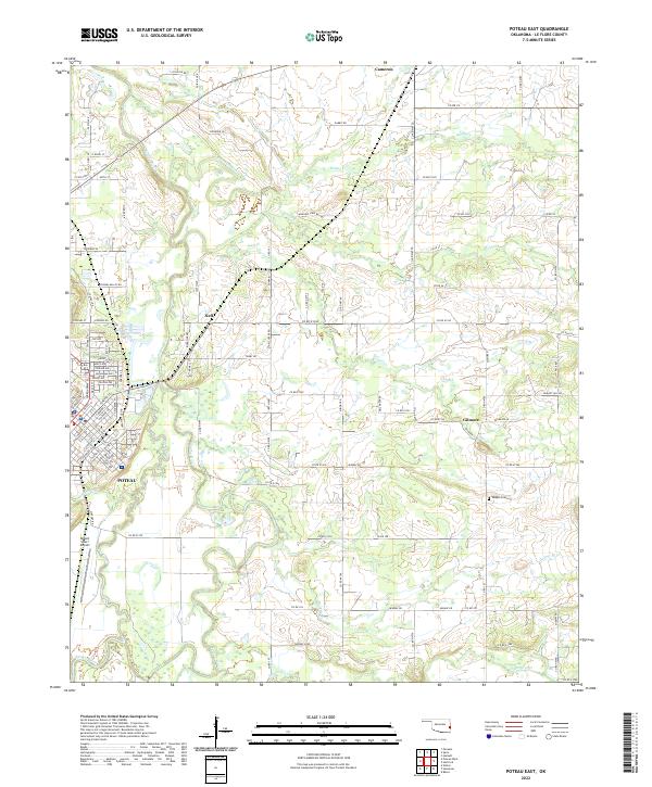
2022 Map of Poteau East
USGS Topo · Published 2022About this map
The winding course of the Poteau River and the complex hydrology of The Cutoff and the Lost Poteau River define this portion of Le Flore County. Located east of the regional hub of Poteau, the landscape is a network of creek drainages including Nail Cr and Riddle Cr that feed into the river valley. The map documents the persistent layout of small rural communities like Neff, Gilmore, and Cameron, which sit alongside a grid of county roads and family-named landmarks such as Vaughn Cem.
Find a feature on this map
87 named features on this map. Tap any name to fly to it.
Don’t see what you’re looking for? This feature index may not catch every label — zoom into the map to look around manually.
Map Details
Editions of this 2022 Poteau East Map
This is the sole edition of this map. No revisions or reprints were ever made.
Other maps of this area

1887 · Poteau Mountain #2
USGS Topo · 1:62,500

1887 · Greenwood
USGS Topo · 1:62,500

1890 · Fort Smith
USGS Topo · 1:125,000

1890 · Poteau Mountain
USGS Topo · 1:125,000

1899 · Poteau Mountain
USGS Topo · 1:125,000

1900 · Sallisaw
USGS Topo · 1:125,000

1900 · Winding Stair
USGS Topo · 1:125,000

1909 · Winding Stair
USGS Topo · 1:125,000

1911 · Sallisaw
USGS Topo · 1:125,000

1943 · Fort Smith
USGS Topo · 1:125,000