1977 Map of Poteau West
USGS Topo · Published 1977About this map
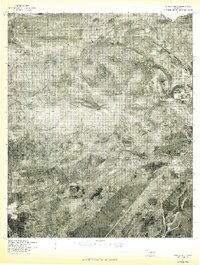
Cavanal Mountain dominates the center of this 1977 aerial survey, casting a high-altitude perspective over the varied terrain of Le Flore County. Produced by the U.S. Geological Survey in cooperation with the Soil Conservation Service, this orthophotoquad reveals the intricate textures of the landscape, from the dense forested slopes of the peak to the sprawling agricultural and residential patterns at its base. The eastern edge of the map shows the transition into more developed areas, where the Poteau River winds through the valley.
Find a feature on this map
6 named features on this map. Tap any name to fly to it.
Don’t see what you’re looking for? This feature index may not catch every label — zoom into the map to look around manually.
Map Details
Editions of this 1977 Poteau West Map
This is the sole edition of this map. No revisions or reprints were ever made.
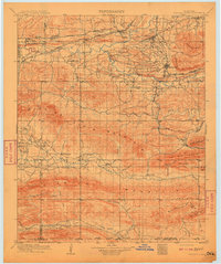
Other maps of this area

1900 · Sallisaw
USGS Topo · 1:125,000

1900 · Winding Stair
USGS Topo · 1:125,000
1909 · Winding Stair
USGS Topo · 1:125,000

1911 · Sallisaw
USGS Topo · 1:125,000

1946 · Fort Smith
USGS Topo · 1:250,000

1950 · Mcalester
USGS Topo · 1:250,000
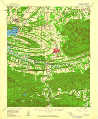
1959 · Heavener
USGS Topo · 1:62,500

1962 · McAlester
USGS Topo · 1:250,000

1965 · Fort Smith
USGS Topo · 1:250,000

1965 · McAlester
USGS Topo · 1:250,000