
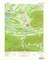
1959 Map of Heavener
USGS Topo · Published 1960About this map
The Poteau River valley dominates this mid-century landscape, where the confluence of several major rail lines once powered local commerce. The town of Heavener stands as a central hub, flanked by the steep slopes of Poteau Mountain to the east and the sprawling waters of Lake Wister to the west. Evidence of the region’s industrial and agricultural character is scattered throughout, from the Strip Mine near Howe to the Fish Hatchery and Waterworks infrastructure.
Find a feature on this map
91 named features on this map. Tap any name to fly to it.
Don’t see what you’re looking for? This feature index may not catch every label — zoom into the map to look around manually.
Map Details
Editions of this 1959 Heavener Map
2 editions found
Other maps of this area

1887 · Poteau Mountain #2
USGS Topo · 1:62,500

1887 · Greenwood
USGS Topo · 1:62,500

1890 · Fort Smith
USGS Topo · 1:125,000

1890 · Poteau Mountain
USGS Topo · 1:125,000

1899 · Poteau Mountain
USGS Topo · 1:125,000

1900 · Sallisaw
USGS Topo · 1:125,000

1900 · Winding Stair
USGS Topo · 1:125,000

1909 · Winding Stair
USGS Topo · 1:125,000

1911 · Sallisaw
USGS Topo · 1:125,000

1943 · Fort Smith
USGS Topo · 1:125,000