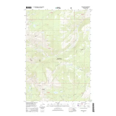
2017 Map of Potosi Peak
USGS Topo · Published 2017About this map
Potosi Peak stands as a central landmark within the Tobacco Root Mountains, surrounded by a high-altitude landscape of alpine lakes and dramatic ridgelines. Most of the terrain falls within the Beaverhead National Forest, where the hydrology is defined by the headwaters of N Willow Cr and S Willow Cr. The presence of the New Deal Mine near N Meadow Cr points to the region's mineral history, while Potosi Hot Springs on Potosi Creek suggests a long-standing point of interest for those traversing the mountains via Potosi Rd.
Find a feature on this map
50 named features on this map. Tap any name to fly to it.
Don’t see what you’re looking for? This feature index may not catch every label — zoom into the map to look around manually.
Map Details
Editions of this 2017 Potosi Peak Map
This is the sole edition of this map. No revisions or reprints were ever made.
Other maps of this area

1888 · Three Forks
USGS Topo · 1:250,000

1893 · Dillon
USGS Topo · 1:250,000

1894 · Three Forks
USGS Topo · 1:250,000

1895 · Three Forks
USGS Topo · 1:250,000

1947 · Bozeman
USGS Topo · 1:250,000

1948 · Bozeman
USGS Topo · 1:250,000

1950 · Harrison
USGS Topo · 1:62,500

1950 · Virginia City
USGS Topo · 1:62,500

1955 · Bozeman
USGS Topo · 1:250,000

1955 · Dillon
USGS Topo · 1:250,000