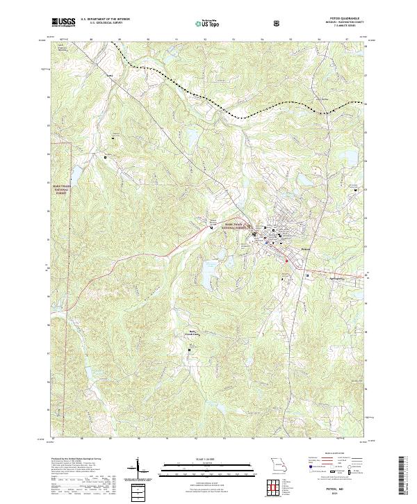
2021 Map of Potosi
USGS Topo · Published 2021About this map
Potosi serves as the focal point of this Washington County landscape, where the Washington County Courthouse stands at the heart of a town defined by its historical burial grounds. The concentrated presence of numerous cemeteries, including Potosi Colored Cem, Saint James Catholic Cem, and the Potosi Presbyterian Cem, reflects a deep genealogical record for the region. Outside the main settlement, the land is marked by the Mark Twain National Forest and industrial traces such as the Settle Mine Tailings Pond near the banks of Mine a Breton Cr. Water features like Hornsey Lake and Russell Elsey Lake punctuate the terrain, while outlying communities like Springtown, Long Hollow, and Lutty are linked by a network of rural roads. To the south, Bates Creek Camp and the Bates Creek Cem offer further points of interest for local historians.
Find a feature on this map
139 named features on this map. Tap any name to fly to it.
Don’t see what you’re looking for? This feature index may not catch every label — zoom into the map to look around manually.
Map Details
Editions of this 2021 Potosi Map
This is the sole edition of this map. No revisions or reprints were ever made.
Other maps of this area

1901 · De Soto
USGS Topo · 1:125,000

1905 · Bonneterre
USGS Topo · 1:62,500

1906 · Potosi
USGS Topo · 1:62,500

1937 · Tiff
USGS Topo · 1:24,000

1939 · Tiff
USGS Topo · 1:24,000

1946 · Richwoods
USGS Topo · 1:62,500

1948 · Richwoods
USGS Topo · 1:62,500

1949 · Saint Louis
USGS Topo · 1:250,000

1949 · Rolla
USGS Topo · 1:250,000

1953 · Rolla
USGS Topo · 1:250,000