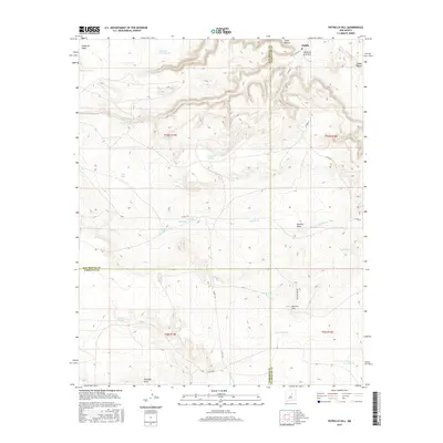
2017 Map of Potrillo Hill
USGS Topo · Published 2017About this map
Dahlia sits at the northern edge of this high-plains landscape where the boundaries of San Miguel, Guadalupe, and Torrance counties meet. The terrain is defined by a series of drainages and seasonal water catchments essential for ranching and land management in this arid region. Significant topographic features include the deep cuts of Cañon Blanco and Cañon de la Luvina, which provide natural relief against the rising elevation of Potrillo Hill.
Find a feature on this map
33 named features on this map. Tap any name to fly to it.
Don’t see what you’re looking for? This feature index may not catch every label — zoom into the map to look around manually.
Map Details
Editions of this 2017 Potrillo Hill Map
This is the sole edition of this map. No revisions or reprints were ever made.
Other maps of this area

1890 · Bernal
USGS Topo · 1:125,000

1891 · Bernal
USGS Topo · 1:125,000

1894 · Bernal
USGS Topo · 1:125,000

1954 · Santa Fe
USGS Topo · 1:250,000

1954 · Fort Sumner
USGS Topo · 1:250,000

1958 · Fort Sumner
USGS Topo · 1:250,000

1958 · Santa Fe
USGS Topo · 1:250,000

1963 · Jacinto Mesa
USGS Topo · 1:24,000
1963 · Anton Chico
USGS Topo · 1:24,000
1963 · Mesa Palo Amarillo
USGS Topo · 1:24,000