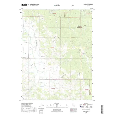
2018 Map of Potter Valley
USGS Topo · Published 2018About this map
Potter Valley sits at the heart of this Mendocino County landscape, where the agricultural flats meet the rising timber of the Mendocino National Forest. The map documents a sophisticated water management network, tracing the Powerhouse Canal, W Canal, and E Canal as they divert flows near the East Fork Russian River. This infrastructure supports the local valley floor, while the rugged terrain to the east is defined by landmarks like Kibbey Peak and Garrett Mtn.
Find a feature on this map
90 named features on this map. Tap any name to fly to it.
Don’t see what you’re looking for? This feature index may not catch every label — zoom into the map to look around manually.
Map Details
Editions of this 2018 Potter Valley Map
This is the sole edition of this map. No revisions or reprints were ever made.
Other maps of this area

1920 · Ukiah
USGS Topo · 1:62,500

1922 · Hullville
USGS Topo · 1:62,500

1938 · Lakeport
USGS Topo · 1:62,500

1943 · Pomo
USGS Topo · 1:62,500

1944 · Ukiah
USGS Topo · 1:62,500

1951 · Lake Pillsbury
USGS Topo · 1:62,500

1951 · Lakeport
USGS Topo · 1:62,500

1957 · Ukiah
USGS Topo · 1:250,000

1958 · Ukiah
USGS Topo · 1:24,000

1958 · Cow Mountain
USGS Topo · 1:24,000