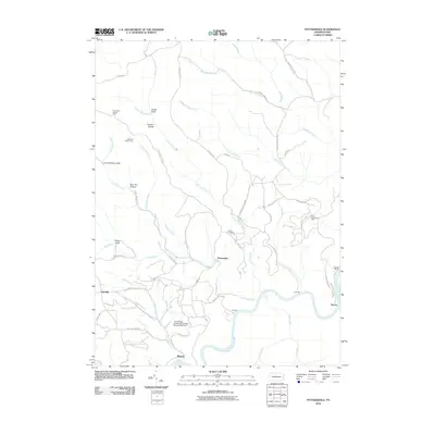
2010 Map of Pottersdale
USGS Topo · Published 2010About this map
Pottersdale and its surrounding hill country are defined by a network of steep hollows and winding tributaries feeding the West Branch Susquehanna River. The landscape reflects a history of resource extraction, evidenced by the Perry Moshannon Mine and the substantial J E Hoffman Number Three Mine Refuse Bank Dam near Belford. These industrial features sit alongside local landmarks like the Ganoe Cemetery and the Three Runs Lookout Tower, which overlooks the transition from the high ridges of Chestnut Ridge Camp to the riverbank at Cataract.
Find a feature on this map
55 named features on this map. Tap any name to fly to it.
Don’t see what you’re looking for? This feature index may not catch every label — zoom into the map to look around manually.
Map Details
Editions of this 2010 Pottersdale Map
This is the sole edition of this map. No revisions or reprints were ever made.
Other maps of this area

1928 · Snow Shoe
USGS Topo · 1:48,000

1929 · Karthaus
USGS Topo · 1:62,500

1931 · Show Shoe
USGS Topo · 1:62,500

1932 · Karthaus
USGS Topo · 1:62,500

1945 · Driftwood
USGS Topo · 1:48,000

1945 · Sinnemahoning
USGS Topo · 1:24,000

1945 · Driftwood
USGS Topo · 1:24,000

1946 · Renovo West
USGS Topo · 1:62,500

1946 · Keating
USGS Topo · 1:24,000

1947 · Sinnemahoning
USGS Topo · 1:24,000
Featured Places
- Karthaus Township, PA
- East Keating Township, PA
- West Keating Township, PA
- Spruce, West Keating Township
- Pottersdale, Karthaus Township