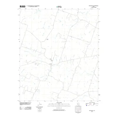
2010 Map of Pottsville
USGS Topo · Published 2010About this map
Pottsville serves as the central hub of this Hamilton County landscape, situated at the confluence of several rural routes including FM 218, FM 221, and Co Rd 618. The community's history is anchored by the Pottsville Cemetery and Immanuel Cemetery, both located just north of the town center near the banks of Cowhouse Creek. This drainage system is part of a wider network of waterways, including Warren Creek, Mesquite Creek, and the curiously named Baptist Branch, which define the local topography.
Find a feature on this map
33 named features on this map. Tap any name to fly to it.
Don’t see what you’re looking for? This feature index may not catch every label — zoom into the map to look around manually.
Map Details
Editions of this 2010 Pottsville Map
This is the sole edition of this map. No revisions or reprints were ever made.
Other maps of this area

1888 · Hamilton
USGS Topo · 1:125,000

1894 · Hamilton
USGS Topo · 1:125,000

1954 · Brownwood
USGS Topo · 1:250,000

1956 · Gustine
USGS Topo · 1:62,500

1956 · Gentrys Mill
USGS Topo · 1:24,000

1956 · Gustine
USGS Topo · 1:24,000

1956 · Pottsville
USGS Topo · 1:62,500

1956 · Hico
USGS Topo · 1:62,500

1956 · Hamilton
USGS Topo · 1:62,500

1956 · Hamilton West
USGS Topo · 1:24,000