
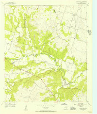
1956 Map of Gentrys Mill
USGS Topo · Published 1957About this map
The Leon River meanders across the Central Texas landscape of the mid-1950s, defining the agricultural and settlement patterns of this region along the Comanche Co Hamilton Co line. Rural life centers around small community hubs like Gentrys Mill, which remains active with its own Gentrys Mill Ch, while the nearby Springtown (Aband) reflects the shifting population as smaller rail stops were left behind. The transition from older transport to new is evident in the parallel paths of the Old Railroad Grade and the modern Memorial Highway.
Find a feature on this map
27 named features on this map. Tap any name to fly to it.
Don’t see what you’re looking for? This feature index may not catch every label — zoom into the map to look around manually.
Map Details
Editions of this 1956 Gentrys Mill Map
2 editions found
Other maps of this area

1888 · Hamilton
USGS Topo · 1:125,000

1894 · Hamilton
USGS Topo · 1:125,000

1954 · Brownwood
USGS Topo · 1:250,000

1956 · Gustine
USGS Topo · 1:62,500

1956 · Pottsville
USGS Topo · 1:62,500

1956 · Hico
USGS Topo · 1:62,500

1956 · Hamilton
USGS Topo · 1:62,500

1956 · Hamilton West
USGS Topo · 1:24,000
1956 · Eidson Lake
USGS Topo · 1:24,000
1956 · Lamkin
USGS Topo · 1:24,000