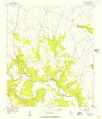
1956 Map of Eidson Lake
USGS Topo · Published 1957About this map
The Leon River winds through the heart of Hamilton County, shaping the local geography as it flows past the substantial reservoir at Eidson Lake. In the mid-1950s, this landscape preserved a deep local history through its family and community landmarks, including the Providence Ch and several burial grounds such as Massingill Cem, Gentry Cem, and Preacher Cem. The presence of a Well and a Pipeline indicates the rural infrastructure of the period, while numerous gravel pits point to the local extractive industry.
Find a feature on this map
21 named features on this map. Tap any name to fly to it.
Don’t see what you’re looking for? This feature index may not catch every label — zoom into the map to look around manually.
Map Details
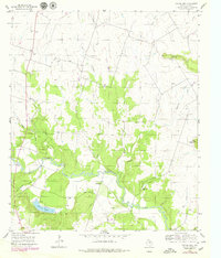
Editions of this 1956 Eidson Lake Map
2 editions found
Other maps of this area

1888 · Hamilton
USGS Topo · 1:125,000

1888 · Meridian
USGS Topo · 1:125,000

1894 · Hamilton
USGS Topo · 1:125,000

1894 · Meridian
USGS Topo · 1:125,000

1954 · Brownwood
USGS Topo · 1:250,000

1954 · Waco
USGS Topo · 1:250,000

1955 · Waco
USGS Topo · 1:250,000

1956 · Gentrys Mill
USGS Topo · 1:24,000

1956 · Hico
USGS Topo · 1:62,500

1956 · Hamilton
USGS Topo · 1:62,500