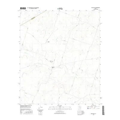
2016 Map of Pottsville
USGS Topo · Published 2016About this map
Pottsville serves as the central hub for this rural portion of Central Texas, where the local landscape is defined by the winding course of Cowhouse Cr. This 2016 survey illustrates a classic ranching and agricultural region, with the town core situated near the confluence of several seasonal waterways including School Land Cr and Mesquite Cr. For those researching family history, the map identifies local burial grounds like Pottsville Cem and Immanuel Cem, both positioned just north of the town center. The terrain is marked by distinctive elevation changes such as Hoover Knobs, providing a clear view of the drainage patterns for Warren Cr and Baptist Br. The road network, consisting of Farm to Market roads like FM 218 and numerous county routes, connects these isolated settlements across the Comanche Co and Hamilton Co line.
Find a feature on this map
35 named features on this map. Tap any name to fly to it.
Don’t see what you’re looking for? This feature index may not catch every label — zoom into the map to look around manually.
Map Details
Editions of this 2016 Pottsville Map
This is the sole edition of this map. No revisions or reprints were ever made.
Other maps of this area

1888 · Hamilton
USGS Topo · 1:125,000

1894 · Hamilton
USGS Topo · 1:125,000

1954 · Brownwood
USGS Topo · 1:250,000

1956 · Gustine
USGS Topo · 1:62,500

1956 · Gentrys Mill
USGS Topo · 1:24,000

1956 · Gustine
USGS Topo · 1:24,000

1956 · Pottsville
USGS Topo · 1:62,500

1956 · Hico
USGS Topo · 1:62,500

1956 · Hamilton
USGS Topo · 1:62,500

1956 · Hamilton West
USGS Topo · 1:24,000