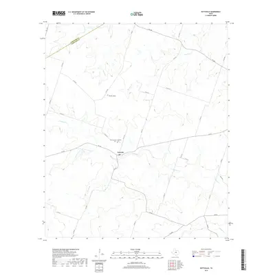
2019 Map of Pottsville
USGS Topo · Published 2019About this map
Pottsville serves as the central hub of this Hamilton County landscape, situated near the intersection of several farm-to-market roads and the winding Cowhouse Cr. This 2019 survey documents a rural environment where land use is closely tied to the drainage patterns of local waterways such as Mesquite Cr and Warren Cr. Genealogists will find the locations of Pottsville Cem and Immanuel Cem northwest of the town center, providing specific points of interest for family history research. To the north, the Hoover Knobs stand out as a notable terrain feature amid a network of county roads like Co RD 619 and Co RD 620. The map also traces smaller tributaries including Baptist Br and School Land Cr, illustrating how the creek systems have influenced the placement of homesteads and transportation routes throughout this part of Central Texas.
Find a feature on this map
37 named features on this map. Tap any name to fly to it.
Don’t see what you’re looking for? This feature index may not catch every label — zoom into the map to look around manually.
Map Details
Editions of this 2019 Pottsville Map
This is the sole edition of this map. No revisions or reprints were ever made.
Other maps of this area

1888 · Hamilton
USGS Topo · 1:125,000

1894 · Hamilton
USGS Topo · 1:125,000

1954 · Brownwood
USGS Topo · 1:250,000

1956 · Gustine
USGS Topo · 1:62,500

1956 · Gentrys Mill
USGS Topo · 1:24,000

1956 · Gustine
USGS Topo · 1:24,000

1956 · Pottsville
USGS Topo · 1:62,500

1956 · Hico
USGS Topo · 1:62,500

1956 · Hamilton
USGS Topo · 1:62,500

1956 · Hamilton West
USGS Topo · 1:24,000