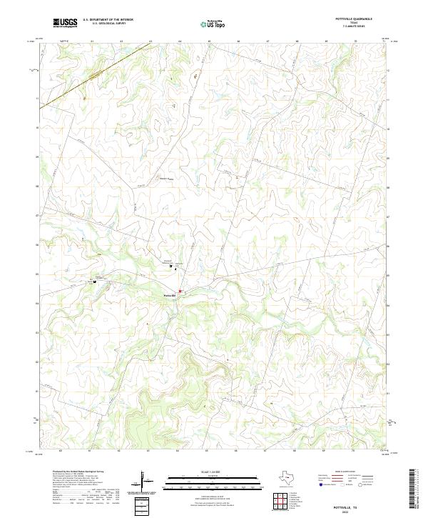
2022 Map of Pottsville
USGS Topo · Published 2022About this map
Pottsville and the surrounding rural landscape of Hamilton County are defined by a network of creeks and several sites of local genealogical significance. The terrain is characterized by the prominent Hoover Knobs to the north and the winding paths of Cowhouse Cr and Warren Cr. A trio of cemeteries north of the main settlement—Immanuel Lutheran Cem, Trinity Lutheran Cem, and the nearby Pottsville Cem—suggests a community rooted in a shared cultural and religious heritage. To the west, the Rea Family Cem provides a more private window into the early family-led settlement of this region. The map captures a contemporary look at the ranching and agricultural country of Central Texas, where local travel still relies on a grid of county roads and state farm-to-market routes like FM 218 and FM 221. Drainage patterns are finely detailed, showing the convergence of School Land Cr and Baptist Br as they feed into the larger watersheds that shaped the local topography.
Find a feature on this map
38 named features on this map. Tap any name to fly to it.
Don’t see what you’re looking for? This feature index may not catch every label — zoom into the map to look around manually.
Map Details
Editions of this 2022 Pottsville Map
This is the sole edition of this map. No revisions or reprints were ever made.
Other maps of this area

1888 · Hamilton
USGS Topo · 1:125,000

1894 · Hamilton
USGS Topo · 1:125,000

1954 · Brownwood
USGS Topo · 1:250,000

1956 · Gustine
USGS Topo · 1:62,500

1956 · Gentrys Mill
USGS Topo · 1:24,000

1956 · Gustine
USGS Topo · 1:24,000

1956 · Pottsville
USGS Topo · 1:62,500

1956 · Hico
USGS Topo · 1:62,500

1956 · Hamilton
USGS Topo · 1:62,500

1956 · Hamilton West
USGS Topo · 1:24,000