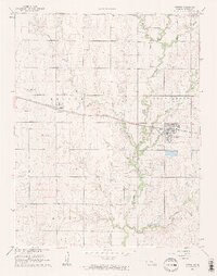
1961 Map of Potwin
USGS Topo · Published 1962About this map
The Oil Refinery at Potwin anchors this industrial and agricultural landscape in central Butler County, with its extensive Settling Basin and protective Levee situated along Brush Creek. This mid-century survey captures the region during a peak of petroleum activity, evidenced by the numerous Oil Wells and the sprawling Potwin Field boundary. The infrastructure of the Missouri Pacific railroad cuts across the prairie, connecting the industrial hub at Potwin with the smaller settlement of Brainerd to the west.
Find a feature on this map
37 named features on this map. Tap any name to fly to it.
Don’t see what you’re looking for? This feature index may not catch every label — zoom into the map to look around manually.
Map Details
Editions of this 1961 Potwin Map
2 editions found
Other maps of this area

1888 · Eldorado
USGS Topo · 1:125,000

1889 · Newton
USGS Topo · 1:125,000

1889 · Wichita
USGS Topo · 1:125,000

1894 · Wichita
USGS Topo · 1:125,000

1894 · Newton
USGS Topo · 1:125,000

1898 · Cottonwood Falls
USGS Topo · 1:125,000

1955 · Benton
USGS Topo · 1:24,000

1955 · Greenwich
USGS Topo · 1:24,000

1955 · Wichita
USGS Topo · 1:250,000

1955 · Hutchinson
USGS Topo · 1:250,000