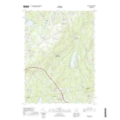
2019 Map of Poughquag
USGS Topo · Published 2019About this map
Beekman and Poughquag anchor this 2019 survey, illustrating the complex landscape where residential growth meets protected corridors in New York. The Appalachian National Scenic Trail winds extensively through the central hills, crossing the Dutchess and Putnam county boundary near Grape Hollow. This edition captures the established footprint of the Stormville Airport and the sprawling Green Haven facility, surrounded by a high density of small cemeteries that reflect the long-standing family lineages of the region, such as Flagler Cem and Ballard Milltown Cem.
Find a feature on this map
175 named features on this map. Tap any name to fly to it.
Don’t see what you’re looking for? This feature index may not catch every label — zoom into the map to look around manually.
Map Details
Editions of this 2019 Poughquag Map
This is the sole edition of this map. No revisions or reprints were ever made.
Other maps of this area

1892 · West Point
USGS Topo · 1:62,500

1892 · Carmel
USGS Topo · 1:62,500

1893 · Carmel
USGS Topo · 1:62,500

1893 · Clove
USGS Topo · 1:62,500

1893 · Poughkeepsie
USGS Topo · 1:62,500

1894 · West Point
USGS Topo · 1:62,500

1894 · Clove
USGS Topo · 1:62,500

1894 · Carmel
USGS Topo · 1:62,500

1894 · Poughkeepsie
USGS Topo · 1:62,500

1898 · Clove
USGS Topo · 1:62,500