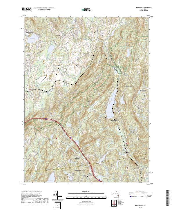
2023 Map of Poughquag
USGS Topo · Published 2023About this map
Whaley Lake and the surrounding highlands of the Dutchess and Putnam County line anchor this modern topographical study. The terrain is defined by significant elevations like Pawling Mountain and Stormville Mountain, which separate the various valley settlements. The corridor of the Appalachian National Scenic Trail winds through the central ridges, passing near West Pawling and Depot Hill. Local history is well-preserved through numerous burial sites including Flagler Cem, Milltown Road Cem, and the Ballard Burying Ground Cem. These features, along with the Stormville Airport and communities like Poughquag, Holmes, and Ludingtonville, illustrate a landscape that maintains its rural character even as modern infrastructure like Interstate 84 passes through the southern reaches. Numerous small water bodies such as Ballard Lake, Sunset Lake, and Harmony Lake dot the valleys, feeding into systems like Fishkill Creek and Whaley Lake Stream.
Find a feature on this map
53 named features on this map. Tap any name to fly to it.
Don’t see what you’re looking for? This feature index may not catch every label — zoom into the map to look around manually.
Map Details
Editions of this 2023 Poughquag Map
This is the sole edition of this map. No revisions or reprints were ever made.
Other maps of this area

1892 · West Point
USGS Topo · 1:62,500

1892 · Carmel
USGS Topo · 1:62,500

1893 · Carmel
USGS Topo · 1:62,500

1893 · Clove
USGS Topo · 1:62,500

1893 · Poughkeepsie
USGS Topo · 1:62,500

1894 · West Point
USGS Topo · 1:62,500

1894 · Clove
USGS Topo · 1:62,500

1894 · Carmel
USGS Topo · 1:62,500

1894 · Poughkeepsie
USGS Topo · 1:62,500

1898 · Clove
USGS Topo · 1:62,500