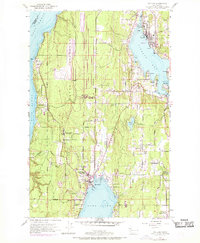
1953 Map of Poulsbo
USGS Topo · Published 1969About this map
Liberty Bay and Dyes Inlet anchor this coastal landscape, which depicts a mid-century Kitsap County defined by maritime activity and naval expansion. The prominent Naval Reservation stretches across the interior, bordering significant civilian settlements at Poulsbo and Silverdale. The drainage of Clear Creek Valley serves as a geographic spine between the inlets, while the infrastructure of the Northern Pacific railroad, including Silverdale Siding, indicates the era's transport reliance. Local history is recorded through the locations of the Poulsbo Cemetery, Pearson Cemetery, and several rural school sites like the Central Kitsap High School. Small communities such as Scandia, Pearson, and Lemolo appear as clusters of development along the waterfront, illustrating the traditional settlement patterns of the Puget Sound before the extensive suburbanization of the late 20th century.
Find a feature on this map
52 named features on this map. Tap any name to fly to it.
Don’t see what you’re looking for? This feature index may not catch every label — zoom into the map to look around manually.
Map Details
Editions of this 1953 Poulsbo Map
4 editions found
Other maps of this area

1936 · Point Misery
USGS Topo · 1:62,500

1937 · Port Orchard
USGS Topo · 1:62,500

1937 · Port Gamble
USGS Topo · 1:62,500

1940 · Port Gamble
USGS Topo · 1:62,500

1940 · Point Misery
USGS Topo · 1:62,500

1940 · Quilcene
USGS Topo · 1:62,500

1953 · Seabeck
USGS Topo · 1:24,000

1953 · Poulsbo
USGS Topo · 1:24,000

1953 · Quilcene
USGS Topo · 1:24,000

1953 · Bremerton West
USGS Topo · 1:24,000