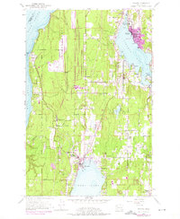
1953 Map of Poulsbo
USGS Topo · Published 1975About this map
Poulsbo and Silverdale anchor this coastal landscape, which showcases the post-war expansion and military presence on the Kitsap Peninsula. The extensive Naval Reservation dominates the western shore along Hood Canal, featuring the Bangor Station and its associated infrastructure. To the east, the shoreline of Liberty Bay is dotted with established waterfront communities like Scandia, Pearson, and Virginia, leading toward the naval facilities at Keyport. The map records a transition toward modern suburban development, particularly evident in the purple-shaded growth areas around Poulsbo and the location of educational institutions like North Kitsap High Sch and Central Kitsap High School. Inland, the terrain is defined by drainages such as Clear Creek and Barker Creek, which cut through the ridges toward Dyes Inlet, while the local transportation network is anchored by historically significant routes like the Willamette Meridian and Military Road.
Find a feature on this map
48 named features on this map. Tap any name to fly to it.
Don’t see what you’re looking for? This feature index may not catch every label — zoom into the map to look around manually.
Map Details
Editions of this 1953 Poulsbo Map
4 editions found
Other maps of this area

1936 · Point Misery
USGS Topo · 1:62,500

1937 · Port Orchard
USGS Topo · 1:62,500

1937 · Port Gamble
USGS Topo · 1:62,500

1940 · Port Gamble
USGS Topo · 1:62,500

1940 · Point Misery
USGS Topo · 1:62,500

1940 · Quilcene
USGS Topo · 1:62,500

1953 · Seabeck
USGS Topo · 1:24,000

1953 · Poulsbo
USGS Topo · 1:24,000

1953 · Quilcene
USGS Topo · 1:24,000

1953 · Bremerton West
USGS Topo · 1:24,000