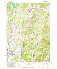
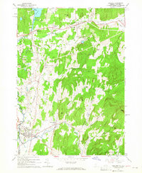
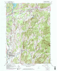
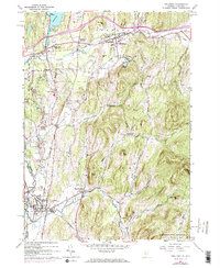
1964 Map of Poultney
USGS Topo · Published 1973About this map
The Castleton River valley serves as a primary corridor for the Hudson and Delaware rail line, connecting the historic educational hubs of Castleton State College and Green Mtn College. This 1960s landscape, later updated in the early 1970s, reveals a region defined by its industrial resources and academic institutions. Numerous quarries and gravel pits are concentrated near Blissville and Hydeville, indicating the local importance of the slate and stone industries during this era.
Find a feature on this map
45 named features on this map. Tap any name to fly to it.
Don’t see what you’re looking for? This feature index may not catch every label — zoom into the map to look around manually.
Map Details
Editions of this 1964 Poultney Map
4 editions found
Other maps of this area

1893 · Fort Ann
USGS Topo · 1:62,500

1893 · Whitehall
USGS Topo · 1:62,500

1894 · Pawlet
USGS Topo · 1:62,500

1895 · Whitehall
USGS Topo · 1:62,500

1895 · Fort Ann
USGS Topo · 1:62,500

1895 · Castleton
USGS Topo · 1:62,500

1897 · Pawlet
USGS Topo · 1:62,500

1897 · Castleton
USGS Topo · 1:62,500

1898 · Whitehall
USGS Topo · 1:62,500

1898 · Fort Ann
USGS Topo · 1:62,500