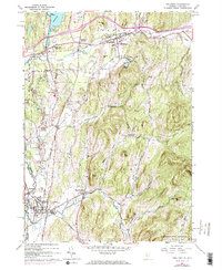
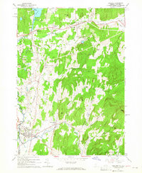
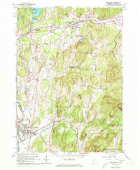
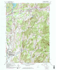
1964 Map of Poultney
USGS Topo · Published 1973About this map
Castleton State College and Green Mtn College serve as major institutional anchors in this region during the mid-1960s, a period marked by established town centers and an active industrial landscape. The western portion of the map is heavily defined by extensive Quarries, particularly around Blissville, where numerous pits are carved into the hills. This extractive industry is supported by the Delaware and Hudson RR, which winds through the valleys connecting Poultney and Castleton.
Find a feature on this map
50 named features on this map. Tap any name to fly to it.
Don’t see what you’re looking for? This feature index may not catch every label — zoom into the map to look around manually.
Map Details
Editions of this 1964 Poultney Map
4 editions found
Other maps of this area

1893 · Fort Ann
USGS Topo · 1:62,500

1893 · Whitehall
USGS Topo · 1:62,500

1894 · Pawlet
USGS Topo · 1:62,500

1895 · Whitehall
USGS Topo · 1:62,500

1895 · Fort Ann
USGS Topo · 1:62,500

1895 · Castleton
USGS Topo · 1:62,500

1897 · Pawlet
USGS Topo · 1:62,500

1897 · Castleton
USGS Topo · 1:62,500

1898 · Whitehall
USGS Topo · 1:62,500

1898 · Fort Ann
USGS Topo · 1:62,500