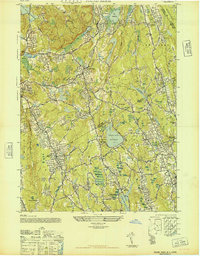
1947 Map of Pound Ridge
USGS Topo · Published 1947About this map
Pound Ridge and the surrounding borderlands of New York and Connecticut appear here in a state of post-war transition, characterized by a sophisticated network of reservoirs and suburbanizing estates. The landscape is defined by massive water management projects including the Cross River Reservoir and Siscowits Reservoir, which sit alongside established country settlements like Lewisboro and Vista. Large private properties, such as the Childs Estate and the New Canaan Country Club, mark the region's character as an emerging residential retreat for the surrounding metropolitan areas.
Find a feature on this map
60 named features on this map. Tap any name to fly to it.
Don’t see what you’re looking for? This feature index may not catch every label — zoom into the map to look around manually.
Map Details
Editions of this 1947 Pound Ridge Map
This is the sole edition of this map. No revisions or reprints were ever made.
Other maps of this area

1892 · Stamford
USGS Topo · 1:62,500

1892 · Danbury
USGS Topo · 1:62,500

1892 · Norwalk
USGS Topo · 1:62,500

1892 · Carmel
USGS Topo · 1:62,500

1893 · Carmel
USGS Topo · 1:62,500

1893 · Stamford
USGS Topo · 1:62,500

1893 · Norwalk
USGS Topo · 1:62,500

1894 · Carmel
USGS Topo · 1:62,500

1899 · Stamford
USGS Topo · 1:62,500

1915 · Danbury
USGS Topo · 1:62,500