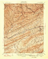
1947 Map of Pounding Mill
USGS Topo · Published 1947About this map
Tazewell and its neighbor North Tazewell anchor this section of southwest Virginia, where the Clinch River cuts through the long, parallel ridges of the Appalachian Valley and Ridge province. The landscape is defined by the industrial and agricultural rhythm of the late 1940s, with the Norfolk and Western railway providing a vital connection through Roukes Gap and along the river banks. Settlements like Pounding Mill and Amonate are clustered in the narrow valleys, supported by a dense network of country schools and churches such as the Witten Valley Ch and Lankous Sch.
Find a feature on this map
100 named features on this map. Tap any name to fly to it.
Don’t see what you’re looking for? This feature index may not catch every label — zoom into the map to look around manually.
Map Details
Editions of this 1947 Pounding Mill Map
2 editions found
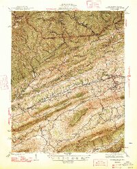
Other maps of this area

1887 · Pocahontas
USGS Topo · 1:125,000

1889 · Wytheville
USGS Topo · 1:125,000

1891 · Tazewell
USGS Topo · 1:125,000

1891 · Pocahontas
USGS Topo · 1:125,000

1891 · Abingdon
USGS Topo · 1:125,000

1892 · Wytheville
USGS Topo · 1:125,000

1894 · Pocahontas
USGS Topo · 1:125,000

1894 · Abingdon
USGS Topo · 1:125,000

1895 · Tazewell
USGS Topo · 1:125,000

1895 · Pocahontas
USGS Topo · 1:125,000