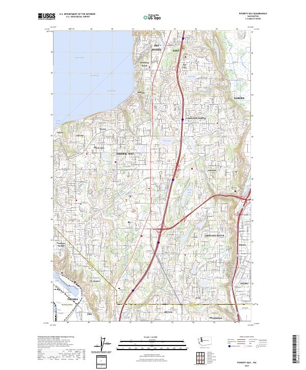
2023 Map of Poverty Bay
USGS Topo · Published 2023About this map
Federal Way and the shoreline of Poverty Bay serve as the focal point for this detailed mapping of the corridor between Seattle and Tacoma. The landscape is a dense network of suburban residential developments and major arterial roads that have integrated once-distinct communities like Lakota, Adelaide, and Buena. To the east, the terrain drops into the Puyallup Valley, where industrial and rail activity around Fife and Milton contrasts with the wooded residential bluffs of Fife Heights. Numerous small glacial lakes, including Steel Lake, Lake Dolloff, and Lake Killarney, are scattered throughout the plateau, many now surrounded by established neighborhoods.
Find a feature on this map
433 named features on this map. Tap any name to fly to it.
Don’t see what you’re looking for? This feature index may not catch every label — zoom into the map to look around manually.
Map Details
Editions of this 2023 Poverty Bay Map
This is the sole edition of this map. No revisions or reprints were ever made.
Other maps of this area

1897 · Tacoma
USGS Topo · 1:125,000

1900 · Tacoma
USGS Topo · 1:125,000

1941 · Tacoma South
USGS Topo · 1:62,500

1942 · Lake Tapps
USGS Topo · 1:62,500

1944 · Lake Tapps
USGS Topo · 1:62,500

1944 · Tacoma South
USGS Topo · 1:62,500

1949 · Tacoma North
USGS Topo · 1:24,000

1949 · Poverty Bay
USGS Topo · 1:24,000

1949 · Renton
USGS Topo · 1:24,000
1949 · Des Moines
USGS Topo · 1:24,000