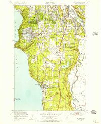
1949 Map of Des Moines
USGS Topo · Published 1956About this map
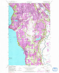
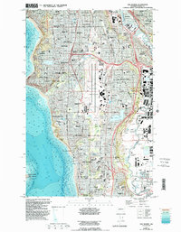
The Seattle Tacoma Airport stands as a massive geometric landmark at the center of this 1949 landscape, surrounded by the rapidly developing neighborhoods of south King County. To the west, the coastline along Puget Sound is dotted with seaside communities like Seola Beach and Secoma Beach, while the interior shows the dense grid of Burien and Sunnydale beginning to consolidate. The eastern edge of the map is defined by the industrial and transport corridor of the Duwamish River and Green River, where the Union Pacific Railroad and Great Northern Railway converge near Tukwila. Local life in the mid-century is captured through features like the Drive-In Theater near Zenith and the numerous small lakes, including Angle Lake and Bow Lake, which provided recreation for residents before the full expansion of the neighboring suburbs.
Find a feature on this map
46 named features on this map. Tap any name to fly to it.
Don’t see what you’re looking for? This feature index may not catch every label — zoom into the map to look around manually.
Map Details
Editions of this 1949 Des Moines Map
6 editions found
Other maps of this area

1894 · Seattle
USGS Topo · 1:62,500

1895 · Snohomish
USGS Topo · 1:125,000

1897 · Tacoma
USGS Topo · 1:125,000

1897 · Seattle
USGS Topo · 1:125,000

1900 · Tacoma
USGS Topo · 1:125,000

1908 · Seattle
USGS Topo · 1:62,500

1909 · Seattle Special
USGS Topo · 1:62,500

1949 · Tacoma North
USGS Topo · 1:24,000

1949 · Poverty Bay
USGS Topo · 1:24,000

1949 · Renton
USGS Topo · 1:24,000