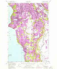
1949 Map of Des Moines
USGS Topo · Published 1976About this map
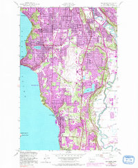
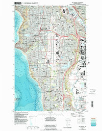
Puget Sound shapes the western edge of this 1949 survey, where coastal settlements like Seahurst, Secoma Beach, and Zenith meet the rising bluffs of the shoreline. The interior landscape is defined by the massive footprint of the Seattle Tacoma International Airport, a central hub around which the residential growth of Burien, Normandy Park, and Des Moines radiates. The eastern corridor follows the meandering Duwamish River and Green River valleys, where the Burlington Northern railroad and the Pacific Highway support the industrial and suburban development of Tukwila and Foster.
Find a feature on this map
59 named features on this map. Tap any name to fly to it.
Don’t see what you’re looking for? This feature index may not catch every label — zoom into the map to look around manually.
Map Details
Editions of this 1949 Des Moines Map
6 editions found
Other maps of this area

1894 · Seattle
USGS Topo · 1:62,500

1895 · Snohomish
USGS Topo · 1:125,000

1897 · Tacoma
USGS Topo · 1:125,000

1897 · Seattle
USGS Topo · 1:125,000

1900 · Tacoma
USGS Topo · 1:125,000

1908 · Seattle
USGS Topo · 1:62,500

1909 · Seattle Special
USGS Topo · 1:62,500

1949 · Tacoma North
USGS Topo · 1:24,000

1949 · Poverty Bay
USGS Topo · 1:24,000

1949 · Renton
USGS Topo · 1:24,000