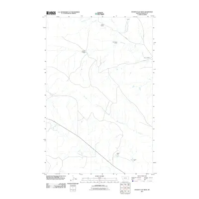
2011 Map of Poverty Flat West
USGS Topo · Published 2011About this map
Kelley Coulee and Cottonwood Coulee define the drainage patterns of this Dawson County landscape, where small-scale water management is evident through numerous local impoundments. The presence of Newton Number 1 Dam, V Dam, and Quaker Dam suggests a focus on livestock watering or erosion control in an environment dominated by seasonal watercourses like Dry Creek and South Fork Deer Creek. Sparse infrastructure is limited to secondary routes such as Road 454 and Road 445, which provide access to the high plains terrain between the larger creek forks. The area is characterized by a network of named coulees, including Cherry Coulee, which serve as primary landmarks in this sparsely populated portion of Montana.
Find a feature on this map
14 named features on this map. Tap any name to fly to it.
Don’t see what you’re looking for? This feature index may not catch every label — zoom into the map to look around manually.
Map Details
Editions of this 2011 Poverty Flat West Map
This is the sole edition of this map. No revisions or reprints were ever made.
Other maps of this area

1909 · Glendive
USGS Topo · 1:250,000

1954 · Glendive
USGS Topo · 1:250,000

1957 · Glendive
USGS Topo · 1:250,000

1958 · Glendive
USGS Topo · 1:250,000
1967 · Forest Park
USGS Topo · 1:24,000

1972 · Morgan Creek School
USGS Topo · 1:24,000
1972 · Pleasant View
USGS Topo · 1:24,000

1972 · Poverty Flat West
USGS Topo · 1:24,000
1972 · Poverty Flat East
USGS Topo · 1:24,000

1972 · Stinking Coulee
USGS Topo · 1:24,000