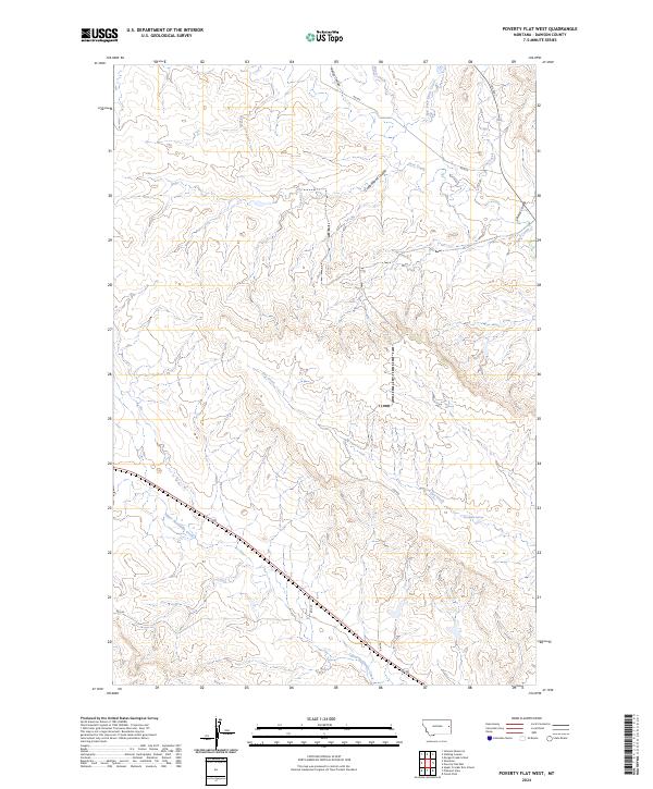
2024 Map of Poverty Flat West
USGS Topo · Published 2024About this map
Elevenmile Springs sits within a network of drainage basins and coulees in this section of Dawson County. The landscape is defined by the headwaters of numerous seasonal streams, including Upper Sevenmile Creek, which cuts diagonally across the southwestern township lines. The drainage pattern here, characterized by features like Cottonwood Coulee and Kelley Coulee, reveals the erosional history of the Montana plains. These natural landmarks provided critical water points for early livestock operations and range management in the region. Transportation is facilitated by local routes such as Fas 254, which connects the northern coulees to the broader county road system. This survey also records the convergence of Deer Creek and Cherry Coulee in the northeastern quadrant, highlighting the intricate hydrology that shaped land division and grazing permits in this part of the state.
Find a feature on this map
18 named features on this map. Tap any name to fly to it.
Don’t see what you’re looking for? This feature index may not catch every label — zoom into the map to look around manually.
Map Details
Editions of this 2024 Poverty Flat West Map
This is the sole edition of this map. No revisions or reprints were ever made.
Other maps of this area

1909 · Glendive
USGS Topo · 1:250,000

1954 · Glendive
USGS Topo · 1:250,000

1957 · Glendive
USGS Topo · 1:250,000

1958 · Glendive
USGS Topo · 1:250,000
1967 · Forest Park
USGS Topo · 1:24,000

1972 · Morgan Creek School
USGS Topo · 1:24,000
1972 · Pleasant View
USGS Topo · 1:24,000

1972 · Poverty Flat West
USGS Topo · 1:24,000
1972 · Poverty Flat East
USGS Topo · 1:24,000

1972 · Stinking Coulee
USGS Topo · 1:24,000