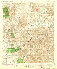
1942 Map of Poway Valley
USGS Topo · Published 1942About this map
Poway and its surrounding canyonlands appear here just as the region began to transition from a rural ranching landscape to a strategic military and residential corridor during the early 1940s. The settlement of Scripps Ranch is visible in the southwest, situated along the dissected terrain of Carroll Canyon. A distinctive wartime feature is the Emergency Landing Field located west of the ranch, reflecting the increased aviation activity near Miramar during this era.
Find a feature on this map
25 named features on this map. Tap any name to fly to it.
Don’t see what you’re looking for? This feature index may not catch every label — zoom into the map to look around manually.
Map Details
Editions of this 1942 Poway Valley Map
2 editions found

Other maps of this area

1893 · El Cajon
USGS Topo · 1:62,500

1893 · Escondido
USGS Topo · 1:62,500

1901 · Elcajon
USGS Topo · 1:62,500

1901 · Escondido
USGS Topo · 1:62,500

1901 · San Luis Rey
USGS Topo · 1:125,000

1903 · Cuyamaca
USGS Topo · 1:125,000

1903 · La Jolla
USGS Topo · 1:62,500

1903 · Elcajon
USGS Topo · 1:62,500

1903 · Ramona
USGS Topo · 1:125,000

1904 · Southern California Sheet No. 2
USGS Topo · 1:250,000