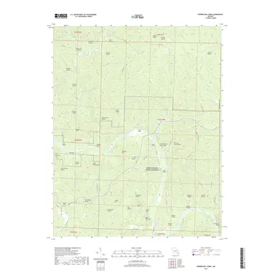
2017 Map of Powder Mill Ferry
USGS Topo · Published 2017About this map
The Current River carves a deep path through this section of the Ozark National Scenic Riverways, a landscape defined by its intricate network of springs and river-carved hollows. Freshwater sources are abundant, from the notable Blue Spring and Powder Mill Spring to smaller outflows like Stroup Spring and Clint Williams Spring. This hydrological system is historically centered on the crossing at Powder Mill Ferry, which, along with the settlement at Owls Bend, provided critical access across the river in a region otherwise dominated by steep peaks such as Wildcat Mtn and Williams Mtn.
Find a feature on this map
88 named features on this map. Tap any name to fly to it.
Don’t see what you’re looking for? This feature index may not catch every label — zoom into the map to look around manually.
Map Details
Editions of this 2017 Powder Mill Ferry Map
This is the sole edition of this map. No revisions or reprints were ever made.
Other maps of this area

1915 · Eminence
USGS Topo · 1:62,500

1917 · Eminence
USGS Topo · 1:62,500

1928 · Cardareva
USGS Topo · 1:62,500

1944 · Corridon
USGS Topo · 1:62,500

1945 · Round Spring
USGS Topo · 1:62,500

1947 · Sinkin
USGS Topo · 1:48,000

1947 · Corridon
USGS Topo · 1:62,500

1949 · Round Spring
USGS Topo · 1:62,500

1949 · Rolla
USGS Topo · 1:250,000

1949 · Cardareva
USGS Topo · 1:62,500