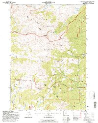
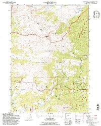
1993 Map of Powder River Pass
USGS Topo · Published 1997About this map
The Bighorn National Forest landscape depicted here centers on the high-elevation transition between the rugged peaks of the Cloud Peak Wilderness and the headwaters of the Powder River. Access through this terrain is defined by the Skyway Scenic Byway, which winds past Powder River Pass and Munkres Pass, connecting the high country to the drainage basins below. Evidence of localized industry and resource extraction is visible through a noted Gold Mine and multiple Gravel Pit sites.
Find a feature on this map
32 named features on this map. Tap any name to fly to it.
Don’t see what you’re looking for? This feature index may not catch every label — zoom into the map to look around manually.
Map Details
Editions of this 1993 Powder River Pass Map
2 editions found
Other maps of this area

1899 · Cloud peak
USGS Topo · 1:125,000

1900 · Fort McKinney
USGS Topo · 1:125,000

1901 · Cloud Peak
USGS Topo · 1:125,000

1903 · Fort McKinney
USGS Topo · 1:125,000

1955 · Sheridan
USGS Topo · 1:250,000

1958 · Sheridan
USGS Topo · 1:250,000

1962 · Sheridan
USGS Topo · 1:250,000
1967 · Onion Gulch
USGS Topo · 1:24,000

1967 · Caribou Creek
USGS Topo · 1:24,000
1967 · Hazelton
USGS Topo · 1:24,000