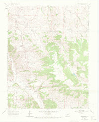
1962 Map of Powderhorn
USGS Topo · Published 1972About this map
Huntsman Mesa dominates the central landscape of this Colorado high-country survey, flanked by a network of drainage gulches and mining prospects. The small settlement of Powderhorn and the Powderhorn PO serve as local landmarks near the thermal waters of Cebolla Hot Springs. The terrain is marked by a history of extraction, evidenced by Ironcap Mine, numerous prospects, and mine dumps scattered near Vulcan and Spencer.
Find a feature on this map
37 named features on this map. Tap any name to fly to it.
Don’t see what you’re looking for? This feature index may not catch every label — zoom into the map to look around manually.
Map Details
Editions of this 1962 Powderhorn Map
3 editions found

Other maps of this area

1908 · Uncompahgre
USGS Topo · 1:125,000

1911 · Uncompahgre
USGS Topo · 1:125,000

1954 · Iris NW
USGS Topo · 1:24,000

1954 · Iola
USGS Topo · 1:24,000

1954 · Cebolla
USGS Topo · 1:24,000

1954 · Gateview
USGS Topo · 1:24,000

1956 · Montrose
USGS Topo · 1:250,000

1959 · Montrose
USGS Topo · 1:250,000

1960 · Montrose
USGS Topo · 1:250,000

1962 · Rudolph Hill
USGS Topo · 1:24,000