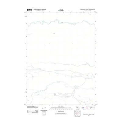
2011 Map of Powderhorn Valley SW
USGS Topo · Published 2011About this map
Snake River meanders across the northern portion of this Nebraska landscape, providing a primary water source in a region defined by its expansive ranching heritage. The presence of Barnes Ranch and Wolfenden Ranch illustrates the traditional land use patterns of Cherry County, where large-scale cattle operations have long shaped the social and economic fabric of the plains. This 2011 survey highlights a network of vital waterways including Boardman Creek, Gordon Creek, and Dry Creek, which drain the undulating terrain south of the river. A singular crossing at Webster Bridge serves as a critical infrastructure point, connecting these isolated ranching homesteads to the broader region. The map reveals the sparsely populated character of the Sandhills, where life revolves around the seasonal rhythms of the water and the management of these large family-held territories.
Find a feature on this map
7 named features on this map. Tap any name to fly to it.
Don’t see what you’re looking for? This feature index may not catch every label — zoom into the map to look around manually.
Map Details
Editions of this 2011 Powderhorn Valley SW Map
This is the sole edition of this map. No revisions or reprints were ever made.
Other maps of this area

1949 · Big Falls
USGS Topo · 1:62,500

1950 · Powderhorn Valley
USGS Topo · 1:62,500

1950 · Doughboy
USGS Topo · 1:62,500

1950 · Wolf Lake
USGS Topo · 1:62,500

1951 · Big Falls
USGS Topo · 1:62,500

1951 · Wolf Lake
USGS Topo · 1:62,500

1952 · Doughboy
USGS Topo · 1:62,500

1957 · Valentine
USGS Topo · 1:250,000

1959 · Valentine
USGS Topo · 1:250,000

1985 · Powderhorn Valley SW
USGS Topo · 1:24,000