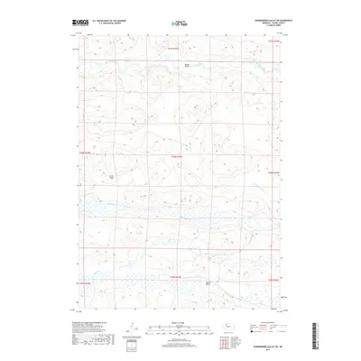
2017 Map of Powderhorn Valley SW
USGS Topo · Published 2017About this map
The Snake River winds across the northern landscape of this Cherry County quadrangle, a defining watercourse in Nebraska's Sandhills region. This 2017 survey illustrates the complex hydrography of the area, characterized by lateral drainages such as Boardman Cr and Gordon Cr that navigate the undulating terrain. A rare point of infrastructure, the Webster Bridge provides a crossing over the river, serving as a vital link in this sparsely populated cattle country.
Find a feature on this map
15 named features on this map. Tap any name to fly to it.
Don’t see what you’re looking for? This feature index may not catch every label — zoom into the map to look around manually.
Map Details
Editions of this 2017 Powderhorn Valley SW Map
This is the sole edition of this map. No revisions or reprints were ever made.
Other maps of this area

1949 · Big Falls
USGS Topo · 1:62,500

1950 · Powderhorn Valley
USGS Topo · 1:62,500

1950 · Doughboy
USGS Topo · 1:62,500

1950 · Wolf Lake
USGS Topo · 1:62,500

1951 · Big Falls
USGS Topo · 1:62,500

1951 · Wolf Lake
USGS Topo · 1:62,500

1952 · Doughboy
USGS Topo · 1:62,500

1957 · Valentine
USGS Topo · 1:250,000

1959 · Valentine
USGS Topo · 1:250,000

1985 · Powderhorn Valley SW
USGS Topo · 1:24,000