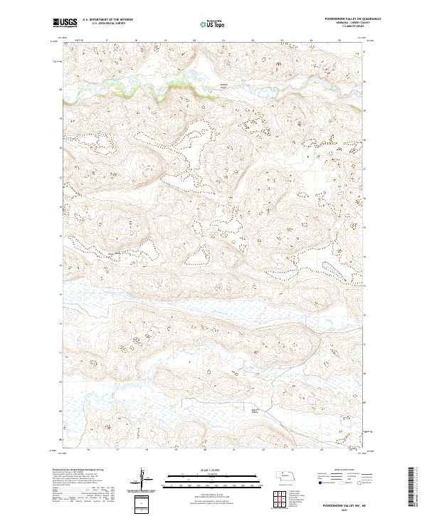
2021 Map of Powderhorn Valley SW
USGS Topo · Published 2021About this map
The Snake River winds across the northern landscape of this Cherry County territory, a remote stretch of Nebraska's sandhills characterized by shallow valley systems and intermittent watercourses. In the central portion of the sheet, Grove Valley provides a distinct geographical pocket near the headwaters of Boardman Cr, while further south, the land yields to the broad expanses of Big Dry Valley. The hydraulic network is defined by seasonal drainages such as Gordon Cr and Dry Cr, which carve subtle depressions through the township lines. A single crossing at Webster Bridge over the river serves as a primary reference point for navigation in this sparsely populated cattle country. The map detail reflects a landscape of sprawling ranchland where natural topographic features and township boundaries remain the most significant landmarks for local history and property research.
Find a feature on this map
14 named features on this map. Tap any name to fly to it.
Don’t see what you’re looking for? This feature index may not catch every label — zoom into the map to look around manually.
Map Details
Editions of this 2021 Powderhorn Valley SW Map
This is the sole edition of this map. No revisions or reprints were ever made.
Other maps of this area

1949 · Big Falls
USGS Topo · 1:62,500

1950 · Powderhorn Valley
USGS Topo · 1:62,500

1950 · Doughboy
USGS Topo · 1:62,500

1950 · Wolf Lake
USGS Topo · 1:62,500

1951 · Big Falls
USGS Topo · 1:62,500

1951 · Wolf Lake
USGS Topo · 1:62,500

1952 · Doughboy
USGS Topo · 1:62,500

1957 · Valentine
USGS Topo · 1:250,000

1959 · Valentine
USGS Topo · 1:250,000

1985 · Powderhorn Valley SW
USGS Topo · 1:24,000