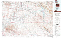
1980 Map of Powell
USGS Topo · Published 1982About this map
Agricultural irrigation networks and rugged geological formations define this 1980s landscape across the Wyoming and Montana border. The Shoshone River and Bighorn River serve as the primary lifelines for the region, feeding extensive water systems like the Cody Canal and supporting settlements such as Powell and Lovell. The terrain is characterized by massive flat-topped features like Polecat Bench and the dramatic drop of Bighorn Canyon, which is preserved within the Bighorn Canyon National Recreation Area.
Find a feature on this map
43 named features on this map. Tap any name to fly to it.
Don’t see what you’re looking for? This feature index may not catch every label — zoom into the map to look around manually.
Map Details
Editions of this 1980 Powell Map
This is the sole edition of this map. No revisions or reprints were ever made.
Other maps of this area

1894 · St. Xavier
USGS Topo · 1:125,000

1898 · Bald Mountain
USGS Topo · 1:125,000

1901 · St. Xavier
USGS Topo · 1:125,000

1901 · Bald Mountain
USGS Topo · 1:125,000

1911 · Oregon Basin
USGS Topo · 1:62,500

1913 · Oregon Basin
USGS Topo · 1:62,500

1944 · Red Lodge
USGS Topo · 1:62,500

1949 · Cody
USGS Topo · 1:62,500

1950 · Clark
USGS Topo · 1:62,500

1951 · Cody
USGS Topo · 1:62,500