
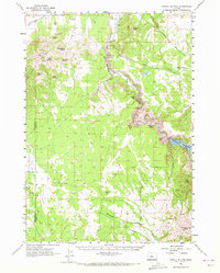
1962 Map of Powell Buttes
USGS Topo · Published 1963About this map
The Crooked River carves a deep path through this landscape, leading into the newly formed Prineville Reservoir following the completion of the Prineville Dam. This early 1960s survey documents a transition in water management and land use, showing critical infrastructure like the Stearns Dam, Hoffman Dam, and the Central Oregon Canal. The terrain is defined by prominent volcanic features including the Powell Buttes and Stearns Butte, while the lower elevations are home to established agricultural holdings such as the Red Cloud Ranch and Stearns Ranch. This map is particularly valuable for its detail on remote spring locations like Deadman Spring and the intricate network of canyons, such as Swartz Canyon and Rocky Canyon, that drain into the central river system.
Find a feature on this map
35 named features on this map. Tap any name to fly to it.
Don’t see what you’re looking for? This feature index may not catch every label — zoom into the map to look around manually.
Map Details
Editions of this 1962 Powell Buttes Map
2 editions found
Other maps of this area

1926 · Bend
USGS Topo · 1:125,000

1929 · Bend
USGS Topo · 1:125,000

1931 · Newberry Crater
USGS Topo · 1:125,000

1935 · Newberry Crater
USGS Topo · 1:125,000

1946 · Eagle Rock
USGS Topo · 1:62,500

1948 · Eagle Rock
USGS Topo · 1:62,500

1948 · Ochoco Reservoir
USGS Topo · 1:62,500

1950 · Ochoco Reservoir
USGS Topo · 1:62,500

1955 · Crescent
USGS Topo · 1:250,000

1955 · Bend
USGS Topo · 1:250,000