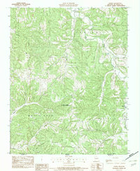
1982 Map of Powell
USGS Topo · Published 1982About this map
Powell sits at the northern edge of this Ozark landscape, where the waters of Mikes Cr and Big Sugar Creek converge. The terrain is defined by a dense network of ridges and hollows, such as Bentonville Ridge and Arch Cave Hollow, which shaped the early settlement patterns of McDonald County in the early 1980s. The southern portion of the map transitions into the Whittenburg Hills and the slopes of White Rock Mountain, eventually crossing the border into Benton County, Arkansas. This survey illustrates the land use of the era, from the preserved area of the Powell Tower Site State Public Hunting Grounds to the family-named landmarks like Grannys Branch and Whittenburg Hills. The map provides a detailed view of the remote drainage systems, including Little Missouri Creek and Bear Cr, that dictated the placement of roads and homesteads in this border region.
Find a feature on this map
31 named features on this map. Tap any name to fly to it.
Don’t see what you’re looking for? This feature index may not catch every label — zoom into the map to look around manually.
Map Details
Editions of this 1982 Powell Map
This is the sole edition of this map. No revisions or reprints were ever made.
Other maps of this area

1899 · Fayetteville
USGS Topo · 1:125,000

1901 · Fayetteville
USGS Topo · 1:125,000

1904 · Fayetteville
USGS Topo · 1:125,000

1940 · Noel
USGS Topo · 1:62,500

1941 · Rocky Comfort
USGS Topo · 1:62,500

1943 · Noel
USGS Topo · 1:62,500

1943 · Rocky Comfort
USGS Topo · 1:62,500

1954 · Tulsa
USGS Topo · 1:250,000

1958 · Pea Ridge
USGS Topo · 1:24,000

1958 · Tulsa
USGS Topo · 1:250,000