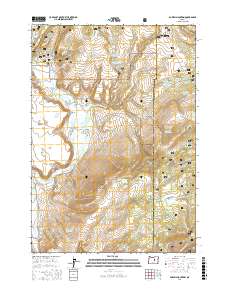
2017 Map of Powell Mountain
USGS Topo · Published 2017About this map
Ochoco National Forest defines this high-elevation landscape in Crook County, where a complex network of water management features reveals the importance of cattle ranching and resource conservation. Numerous reservoirs such as Bear Butte Reservoir, Boundary Reservoir, and the tiered Heisler Reservoir Number One and Heisler Reservoir Number Two are distributed across the terrain, supported by natural sources like Rock Spring and Bob Spring. The topographic character is marked by distinctive formations including Laughlin Table and Stockade Point, while the prominent summit of Powell Mountain overlooks Powell Valley and the grassy expanse of Sunflower Flats. Transportation in this part of the forest relies on designated routes like Natl Forest Develop Road 58 Rd, which provides access to geographic landmarks such as Hardscrabble Ridge and Bellworm Canyon.
Find a feature on this map
65 named features on this map. Tap any name to fly to it.
Don’t see what you’re looking for? This feature index may not catch every label — zoom into the map to look around manually.
Map Details
Editions of this 2017 Powell Mountain Map
This is the sole edition of this map. No revisions or reprints were ever made.
Other maps of this area

1932 · Dayville
USGS Topo · 1:125,000

1936 · Dayville
USGS Topo · 1:125,000

1955 · Canyon City
USGS Topo · 1:250,000

1959 · Canyon City
USGS Topo · 1:250,000

1966 · Six Corners
USGS Topo · 1:24,000

1972 · Wolf Mountain
USGS Topo · 1:24,000
1972 · Aldrich Gulch
USGS Topo · 1:24,000
1981 · Powell Mtn
USGS Topo · 1:24,000

1981 · Suplee
USGS Topo · 1:24,000

1981 · Dayville
USGS Topo · 1:100,000