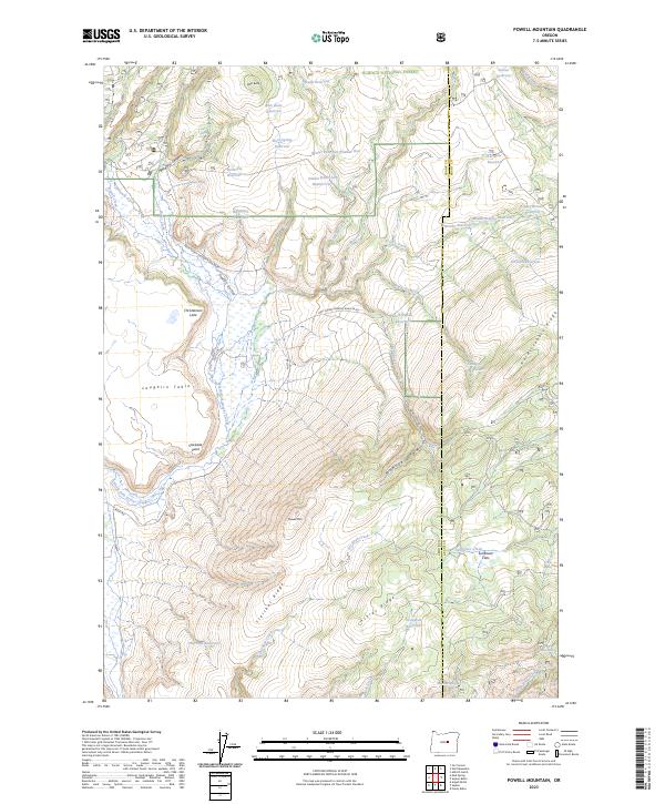
2023 Map of Powell Mountain
USGS Topo · Published 2023About this map
Powell Mtn anchors this high-elevation landscape within the Ochocho National Forest, where the terrain is defined by a sophisticated network of water management and high-desert topography. The presence of numerous small-scale reservoirs, such as Heisler Reservoir Number One, Rock Spring Reservoir, and Turnpike Reservoir, reflects a reliance on seasonal catchment to support land use in this arid region. The drainage patterns are clearly marked by Powell Valley and the North Fork Beaver Creek, which slice through prominent landforms like Laughlin Table and Stockade Point. These features, combined with family-named landmarks like Christiansen Lake and Treichel Ridge, illustrate how individual ranching or grazing efforts have historically adapted to the remote terrain of central Oregon.
Find a feature on this map
59 named features on this map. Tap any name to fly to it.
Don’t see what you’re looking for? This feature index may not catch every label — zoom into the map to look around manually.
Map Details
Editions of this 2023 Powell Mountain Map
This is the sole edition of this map. No revisions or reprints were ever made.
Other maps of this area

1932 · Dayville
USGS Topo · 1:125,000

1936 · Dayville
USGS Topo · 1:125,000

1955 · Canyon City
USGS Topo · 1:250,000

1959 · Canyon City
USGS Topo · 1:250,000

1966 · Six Corners
USGS Topo · 1:24,000

1972 · Wolf Mountain
USGS Topo · 1:24,000
1972 · Aldrich Gulch
USGS Topo · 1:24,000
1981 · Powell Mtn
USGS Topo · 1:24,000

1981 · Suplee
USGS Topo · 1:24,000

1981 · Dayville
USGS Topo · 1:100,000