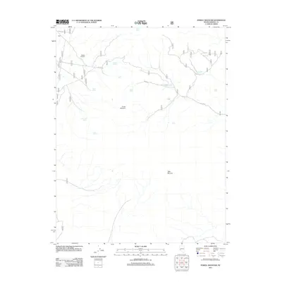
2011 Map of Powell Mountain
USGS Topo · Published 2011About this map
Powell Mountain and Table Mountain dominate this high-desert terrain in Mineral County, Nevada, where the availability of water dictates the landscape's history. The 2011 survey reveals an intricate network of remote water sources essential for survival in this arid environment, ranging from Buller Spring in the north to Aspen Spring further south. These points, including Log Cabin Spring and Upper Powell Canyon Spring, often indicate the sites of early ranching activity or seasonal camps. The presence of NFD 026 RD serves as the primary artery through the high country, connecting deep geographic features like Buller Canyon with the surrounding heights. This map is a record of the persistent reliance on these small, named seeps and springs in a region defined by its isolation and topographical extremes.
Find a feature on this map
16 named features on this map. Tap any name to fly to it.
Don’t see what you’re looking for? This feature index may not catch every label — zoom into the map to look around manually.
Map Details
Editions of this 2011 Powell Mountain Map
This is the sole edition of this map. No revisions or reprints were ever made.
Other maps of this area

1909 · Hawthorne
USGS Topo · 1:250,000

1911 · Hawthorne
USGS Topo · 1:250,000

1915 · Hawthorne
USGS Topo · 1:250,000

1948 · Walker Lake
USGS Topo · 1:250,000

1955 · Powell Mtn
USGS Topo · 1:62,500

1956 · Aurora
USGS Topo · 1:62,500

1957 · Walker Lake
USGS Topo · 1:250,000

1958 · Trench Canyon
USGS Topo · 1:62,500

1958 · Huntoon Valley
USGS Topo · 1:62,500

1962 · Walker Lake
USGS Topo · 1:250,000