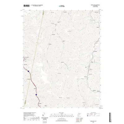
2019 Map of Powellton
USGS Topo · Published 2019About this map
Armstrong Creek and its many tributaries carve through the heart of the Kanawha and Fayette County borderlands, anchoring a landscape defined by narrow valley settlements and high ridges. The community of Powellton sits centrally along the creek, flanked by historic mining and residential outposts such as Elkridge, McDunn, and Greencastle. These settlements are deeply integrated with the rugged topography, where hollows like Cokeoven Hollow and Glenco Hollow hint at the industrial history of the region.
Find a feature on this map
72 named features on this map. Tap any name to fly to it.
Don’t see what you’re looking for? This feature index may not catch every label — zoom into the map to look around manually.
Map Details
Editions of this 2019 Powellton Map
This is the sole edition of this map. No revisions or reprints were ever made.
Other maps of this area

1891 · Raleigh
USGS Topo · 1:125,000

1897 · Kanawha Falls
USGS Topo · 1:125,000

1897 · Raleigh
USGS Topo · 1:125,000

1900 · Kanawha Falls
USGS Topo · 1:125,000

1901 · Kanawha Falls
USGS Topo · 1:125,000

1902 · Raleigh
USGS Topo · 1:125,000

1908 · Fayetteville
USGS Topo · 1:48,000

1908 · Montgomery
USGS Topo · 1:48,000

1910 · Fayetteville
USGS Topo · 1:62,500

1910 · Montgomery
USGS Topo · 1:62,500