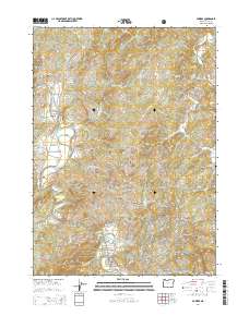
2014 Map of Powers
USGS Topo · Published 2014About this map
The town of Powers sits at the southern edge of this 2014 survey, where the valley of the South Fork Coquille River meets the northern boundary of the Siskiyou National Forest. This region of Coos County is defined by its deep drainages and ridges, including Ben Grant Ridge and the prominent Suicide Rock. Small settlements like Gaylord and Bancroft are connected by roads that snake through the mountain terrain, such as Highway 242 and Mill Creek Rd. For those researching local families, the map identifies several scattered burial sites including Neal Cem, Myrtle Creek Cem, and the lone Warner Grave. The industrial and transport history of the area is visible through features like Railroad Ave in Powers and various logging or access routes like Yellow Creek Ln and N Woodward Creek Ln.
Find a feature on this map
53 named features on this map. Tap any name to fly to it.
Don’t see what you’re looking for? This feature index may not catch every label — zoom into the map to look around manually.
Map Details
Editions of this 2014 Powers Map
This is the sole edition of this map. No revisions or reprints were ever made.
Other maps of this area

1896 · Coos Bay
USGS Topo · 1:125,000

1898 · Coos Bay
USGS Topo · 1:125,000

1899 · Port Orford
USGS Topo · 1:125,000

1900 · Coos Bay
USGS Topo · 1:125,000

1903 · Port Orford
USGS Topo · 1:125,000

1928 · Sitkum
USGS Topo · 1:125,000

1942 · Coquille
USGS Topo · 1:62,500

1945 · Coquille
USGS Topo · 1:62,500

1954 · Coos Bay
USGS Topo · 1:250,000

1954 · Bone Mountain
USGS Topo · 1:62,500