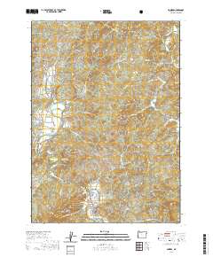
2020 Map of Powers
USGS Topo · Published 2020About this map
The South Fork Coquille River defines the western valley of this Coos County quadrangle, where the town of Powers serves as a central hub. This 2020 survey illustrates a landscape of established timber routes and river-bottom settlements, connected by a network of rural roads like Myrtle Creek Rd and Yellow Creek Ln. For genealogists and local historians, the map is remarkably dense with burial sites and family landmarks, ranging from the Warner Grave near the river to the Myrtle Creek Cem in the northeast. The geography transitions from the river flats near Gaylord into the significant elevations of Ben Grant Ridge, Samison Mtn, and Bingham Mtn. Evidence of the region’s logistical history is preserved in the Railroad Grade running parallel to the river, while natural features like Powers Pond and Pyramid Rock provide clear navigational reference points across the varying terrain.
Find a feature on this map
53 named features on this map. Tap any name to fly to it.
Don’t see what you’re looking for? This feature index may not catch every label — zoom into the map to look around manually.
Map Details
Editions of this 2020 Powers Map
This is the sole edition of this map. No revisions or reprints were ever made.
Other maps of this area

1896 · Coos Bay
USGS Topo · 1:125,000

1898 · Coos Bay
USGS Topo · 1:125,000

1899 · Port Orford
USGS Topo · 1:125,000

1900 · Coos Bay
USGS Topo · 1:125,000

1903 · Port Orford
USGS Topo · 1:125,000

1928 · Sitkum
USGS Topo · 1:125,000

1942 · Coquille
USGS Topo · 1:62,500

1945 · Coquille
USGS Topo · 1:62,500

1954 · Coos Bay
USGS Topo · 1:250,000

1954 · Bone Mountain
USGS Topo · 1:62,500