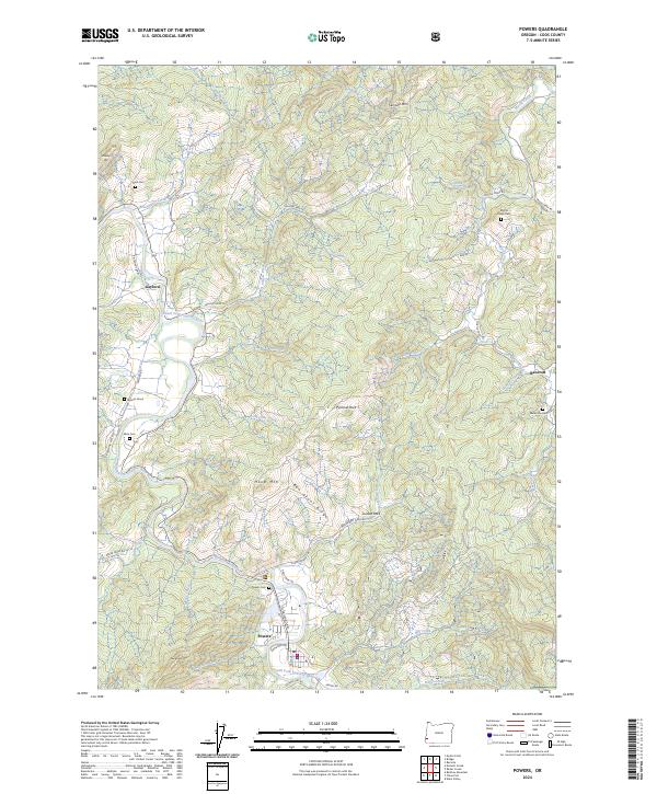
2024 Map of Powers
USGS Topo · Published 2024About this map
Powers serves as a central point of this coastal range landscape, situated along the South Fork Coquille River where mountain ridges give way to valley floor. The town's layout is defined by its timber and transit history, with N Railroad Ave and an old Railroad Grade tracking the river's course northward toward Gaylord. This contemporary survey identifies numerous family and community landmarks essential for local history, including the isolated Warner Grave, Neal Cem, and Wise Cem. The surrounding terrain is marked by prominent elevations such as Hood Mtn and Pyramid Rock, while a dense network of watercourses like Long Tom Creek and Beaver Creek carve through the high ridges of Ben Grant Ridge. This modern mapping provides a clear record of the enduring road network, from Agness Rd to the high Myrtle Creek Rd.
Find a feature on this map
53 named features on this map. Tap any name to fly to it.
Don’t see what you’re looking for? This feature index may not catch every label — zoom into the map to look around manually.
Map Details
Editions of this 2024 Powers Map
This is the sole edition of this map. No revisions or reprints were ever made.
Other maps of this area

1896 · Coos Bay
USGS Topo · 1:125,000

1898 · Coos Bay
USGS Topo · 1:125,000

1899 · Port Orford
USGS Topo · 1:125,000

1900 · Coos Bay
USGS Topo · 1:125,000

1903 · Port Orford
USGS Topo · 1:125,000

1928 · Sitkum
USGS Topo · 1:125,000

1942 · Coquille
USGS Topo · 1:62,500

1945 · Coquille
USGS Topo · 1:62,500

1954 · Coos Bay
USGS Topo · 1:250,000

1954 · Bone Mountain
USGS Topo · 1:62,500