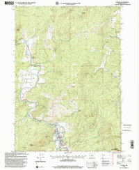
1998 Map of Powers
USGS Topo · Published 2001About this map
The South Fork Coquelle River winds through this 1998 survey, anchoring a landscape where timber and transit meet the northern edge of the Siskiyou National Forest. The town of Powers serves as the primary hub, situated near the Powers Ranger Station and Powers County Park. Small settlements like Gaylord and Bancroft dot the valley floor, connected by the Rogue Scenic Byway as it follows the river's bend.
Find a feature on this map
51 named features on this map. Tap any name to fly to it.
Don’t see what you’re looking for? This feature index may not catch every label — zoom into the map to look around manually.
Map Details
Editions of this 1998 Powers Map
This is the sole edition of this map. No revisions or reprints were ever made.
Other maps of this area

1896 · Coos Bay
USGS Topo · 1:125,000

1898 · Coos Bay
USGS Topo · 1:125,000

1899 · Port Orford
USGS Topo · 1:125,000

1900 · Coos Bay
USGS Topo · 1:125,000

1903 · Port Orford
USGS Topo · 1:125,000

1928 · Sitkum
USGS Topo · 1:125,000

1942 · Coquille
USGS Topo · 1:62,500

1945 · Coquille
USGS Topo · 1:62,500

1954 · Coos Bay
USGS Topo · 1:250,000

1954 · Bone Mountain
USGS Topo · 1:62,500