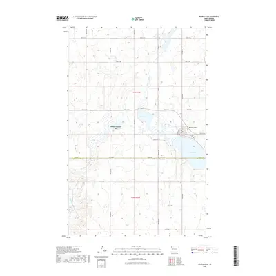
2020 Map of Powers Lake
USGS Topo · Published 2020About this map
The Powers Lake settlement occupies the eastern edge of this landscape, situated alongside the large body of water for which it is named. This area on the Burke and Mountrail County line is defined by a dense network of seasonal wetlands and prairie potholes, including Enget Lake and the marshy reaches of Paradise Meadow. The headwaters of the White Earth River wind through the southwestern portion of the terrain, illustrating the glacial drainage patterns characteristic of the Missouri Coteau region.
Find a feature on this map
30 named features on this map. Tap any name to fly to it.
Don’t see what you’re looking for? This feature index may not catch every label — zoom into the map to look around manually.
Map Details
Editions of this 2020 Powers Lake Map
This is the sole edition of this map. No revisions or reprints were ever made.
Other maps of this area

1953 · Williston
USGS Topo · 1:250,000

1957 · Williston
USGS Topo · 1:250,000

1969 · Ross NW
USGS Topo · 1:24,000

1969 · White Earth
USGS Topo · 1:24,000
1974 · Helde Lake
USGS Topo · 1:24,000

1974 · Grubb Lake
USGS Topo · 1:24,000

1974 · Grand View
USGS Topo · 1:24,000

1977 · Powers Lake
USGS Topo · 1:24,000

1978 · Battleview
USGS Topo · 1:24,000
1978 · Lunds Valley
USGS Topo · 1:24,000