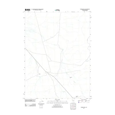
2011 Map of Powers Well
USGS Topo · Published 2011About this map
Powers Well sits at the center of this 2011 survey, a vital water point in a landscape defined by the sparse resources of Washoe County. This high-desert terrain reveals a network of seasonal water sources and ranching infrastructure, such as the Three-C Windmill and the Cold Weather Reservoir. The topography transitions from the broad expanse of Antelope Flat toward the higher ground of Crabapple Ridge to the south. East Creek meanders through the central basin, its drainage patterns indicating the delicate hydrology of the Great Basin. Remote access is provided by Hays Canyon Rd, which cuts diagonally across the quadrangle, serving as the primary corridor through this open range. This map documents a quiet corner of Nevada where names like Lone Juniper Spring reflect the solitary landmarks used by generations of land managers and ranchers.
Find a feature on this map
8 named features on this map. Tap any name to fly to it.
Don’t see what you’re looking for? This feature index may not catch every label — zoom into the map to look around manually.
Map Details
Editions of this 2011 Powers Well Map
This is the sole edition of this map. No revisions or reprints were ever made.
Other maps of this area

1889 · Long Valley
USGS Topo · 1:250,000

1954 · Vya
USGS Topo · 1:250,000

1958 · Vya
USGS Topo · 1:250,000

1962 · Vya
USGS Topo · 1:250,000

1966 · Vya
USGS Topo · 1:24,000

1966 · Massacre Creek
USGS Topo · 1:24,000

1966 · Painted Point
USGS Topo · 1:24,000

1978 · Hart Mountain
USGS Topo · 1:24,000
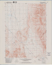
1979 · Powers Well
USGS Topo · 1:24,000
1979 · Nellie Spring Mtn
USGS Topo · 1:24,000