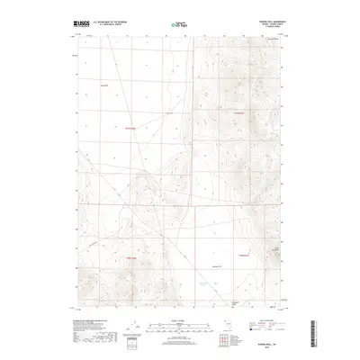
2018 Map of Powers Well
USGS Topo · Published 2018About this map
Powers Well sits at the heart of this high-desert landscape in northern Washoe County, where water sources dictate the geography of human activity and survival. This 2018 survey reveals a terrain defined by stark elevation changes, from the depths of Long Valley to the peaks of the Massacre Range and Nellie Spring Mtn. Transportation is sparse, anchored primarily by C R 34 and Hays Canyon Rd, which navigate the broad expanses of Antelope Flat. For those tracking the history of range management and early ranching, the locations of Lone Juniper Spring and the Cold Weather Reservoir offer critical insights into how the land was utilized. The map serves as a detailed record of this remote corner of Nevada, where names like Crabapple Ridge and E Cr mark a landscape shaped more by geology and hydrology than by settlement.
Find a feature on this map
15 named features on this map. Tap any name to fly to it.
Don’t see what you’re looking for? This feature index may not catch every label — zoom into the map to look around manually.
Map Details
Editions of this 2018 Powers Well Map
This is the sole edition of this map. No revisions or reprints were ever made.
Other maps of this area

1889 · Long Valley
USGS Topo · 1:250,000

1954 · Vya
USGS Topo · 1:250,000

1958 · Vya
USGS Topo · 1:250,000

1962 · Vya
USGS Topo · 1:250,000

1966 · Vya
USGS Topo · 1:24,000

1966 · Massacre Creek
USGS Topo · 1:24,000

1966 · Painted Point
USGS Topo · 1:24,000

1978 · Hart Mountain
USGS Topo · 1:24,000
1979 · Powers Well
USGS Topo · 1:24,000
1979 · Nellie Spring Mtn
USGS Topo · 1:24,000